The application has mainly been tested on a Samsung Galaxy Watch.

Accessible via button on the right.
Allows selection of map layer (currently OpenTopoMap or MapBox GL) and enable/disable heart rate monitoring.
By default the app uses Samsung Health to record GPS data ("Batch Location API" - which seems to be the most energy efficient way), but it can be set to use the native GPS APIs.
Advanced users can also add additional map layers like those listed at OSM's Tile Servers page.
Accessible via button on the left.
Bottom toolbar buttons
Files need to be located in "Documents" (with extension .gpx) on the device
Files will be stored in "Documents" (with extension .gpx) on the device
The Samsung wearable app includes a file transfer feature to allow transferring files from another device (laptop, PC, smart phone) to transfer GPX files to the watch over a WiFi network connection. Both devices need to be connected to the same WiFi network (or be connected without a firewall in between).
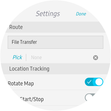
On the main settings screen click the "File Transfer" button. If you haven't connected your watch to the local WiFi network, you will be prompted to do so.
![]()
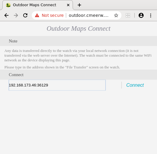
Just follow the instructions.
![]()
Open outdoor.cmeerw.net from the device you want to transfer files from/to, enter the address as shown on the watch and click "Connect". (Sometimes it takes a few attempts to connect. Note that the site will be shown as "Not secure", but keep in mind that data is only transferred directly within your local network)
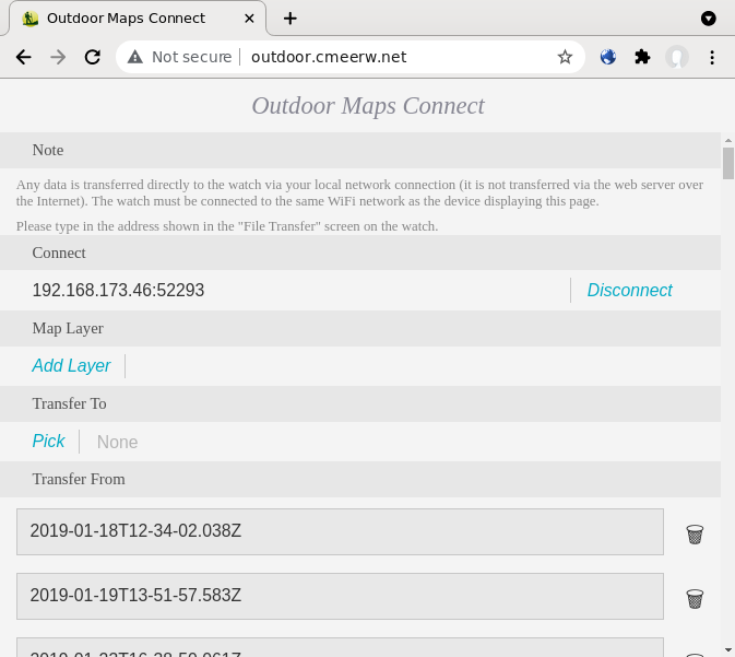
Once connected you have the option to transfer "GPX" files to the watch by clicking on "Pick" or transfer any of the GPX files from the watch just by clicking on the name.
On the "Settings" page, tap on "···" to go to the "Layers" page.
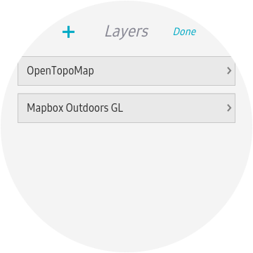
Tap on "+" to go to the "Add Layer" page and fill in the fields.
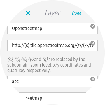
For the OpenStreetMap tile server the settings are (other examples can be found on OSM's Tile servers page):
Openstreetmap
http://{s}.tile.openstreetmap.org/{z}/{x}/{y}.png
abc
© OpenStreetMap contributors
When finished tap on "Done".
The application caches map data on the device and can be switched into an offline mode where it only uses locally stored map data (so it doesn't use up your data allowance when on the move).
It is recommended to pre-cache the relevant area of the map before going on a hike.
The application does not collect any user data.
Brought to you by Christof Meerwald Dev Consulting.